 Acidic Mixed Shrub - Sphagnum Wetland
System: PalustrineSubsystem: Shrubland
PA Ecological Group(s): Peatland Wetland
Global Rank: GNR
![]() rank interpretation
rank interpretation
State Rank: S4
General Description
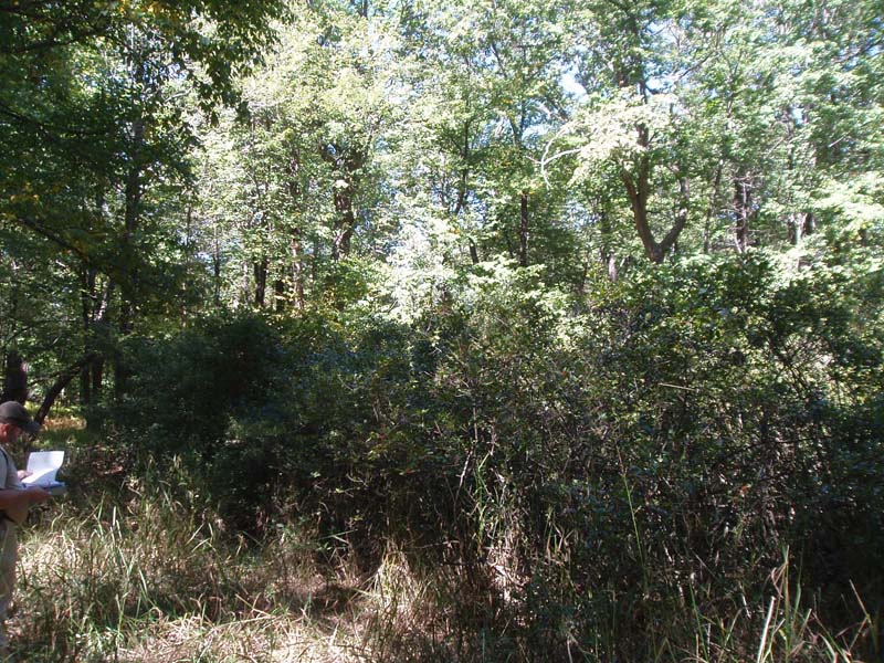
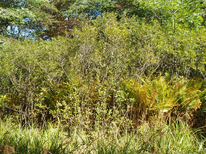
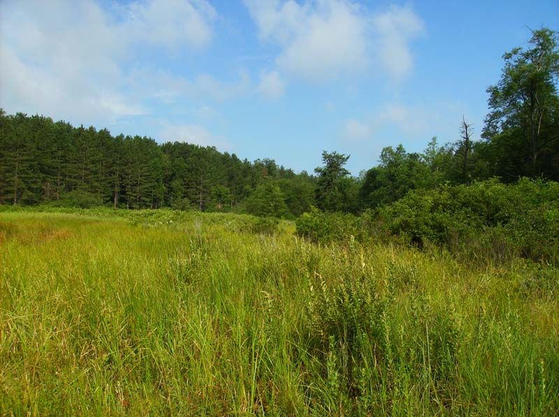
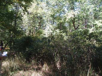
This community type typically occurs in upland depressions, along slow-moving streams, or associated with large wetland complexes, frequently influenced by beaver action or other impoundment. When part of a wetland complex, this community generally occurs at the landward edge of the acidic peat mat where it receives more enriched waters from groundwater discharge and/or inflow from the surrounding watershed. Hydrological conditions can range from temporarily flooded to seasonally flooded, or even saturated. The substrate may be peat or mineral soil with a substantial accumulation of organic matter. The pH of this community type is usually at the lower end of the spectrum as indicated by the presence of more acidophilic species.
The community type is characterized by a substantial tall-shrub layer that may be dominated by a single species or a patchwork of mixed species. Shrub species may include: smooth alder (Alnus serrulata), speckled alder (A. incana ssp. rugosa), highbush blueberry (Vaccinium corymbosum), maleberry (Lyonia ligustrina), winterberry (Ilex verticillata), mountain holly (Ilex mucronata), and leatherleaf (Chamaedaphne calyculata). The herbaceous layer may vary from sparse to patchily dense. Swamp dewberry (Rubus hispidus) is often found in the herbaceous layer along with mostly ferns and sedges. A distinguishing characteristic of this community type is the presence of an extensive sphagnum (Sphagnum spp.) layer.
Rank Justification
Uncommon but not rare; some cause for long-term concern due to declines or other factors.
Identification
- Occurs on saturated or semi-saturated soils in upland depressions, along slow-moving streams, or the landward edge of large wetland complexes
- Soils are very poorly drained peat or mineral soils with a substantial organic layer
- The pH of this wetland type is more acidic and is reflected in the associated shrub species and the presence of an extensive sphagnum layer
- Shrub layer may be dominated by a single shrub species or a mix of species with most being acidophiles
- An extensive sphagnum layer is present
Characteristic Species*
Shrubs
- Smooth alder (Alnus serrulata)
- Speckled alder (Alnus incana ssp. rugosa)
- Highbush blueberry (Vaccinium corymbosum)
- Maleberry (Lyonia ligustrina)
- Mountain holly (Ilex mucronata)
- Leatherleaf (Chamaedaphne calyculata var. angustifolia)
- Black chokeberry (Photinia melanocarpa)
- Swamp azalea (Rhododendron viscosum)
- Rhodora (Rhododendron canadense)
- Sheep laurel (Kalmia angustifolia)
Herbs
- Cinnamon fern (Osmunda cinnamomea)
- Marsh fern (Thelypteris palustris)
- Swamp dewberry (Rubus hispidus)
Vines
Bryophytes
*Vascular plant nomenclature follows Rhoads and Block (2007). Bryophyte nomenclature follows Crum and Anderson (1981).
International Vegetation Classification Associations:
Northern Peatland Shrub Swamp (CEGL006158)
NatureServe Ecological Systems:
Boreal-Laurentian Bog (CES103.581)
Origin of Concept
Fike, J. 1999. Terrestrial and palustrine plant communities of Pennsylvania. Pennsylvania Natural Diversity Inventory. Harrisburg, PA. 86 pp.
Pennsylvania Community Code*
SS : Alder - Sphagnum Wetland
*(DCNR 1999, Stone 2006)
Similar Ecological Communities
Acidic Mixed Shrub - Sphagnum Wetland differs from Circumneutral Mixed Shrub Wetland in that the Acidic Mixed Shrub - Sphagnum Wetland occupies the lower end of the pH spectrum while the latter is circumneutral to somewhat calcareous. The associate species reflect this shift, with acidophiles such as highbush blueberry (Vaccinium corymbosum) and maleberry (Lyonia ligustrina) occurring as associate species in the Acidic Mixed Shrub - Sphagnum Wetland, while shrubs like dogwoods (Cornus spp.) and viburnums (Viburnum spp.) occur in a more circumneutral setting. The presence of a substantial sphagnum layer within the Acidic Mixed Shrub - Sphagnum Wetland generally distinguishes the two community types.
Fike Crosswalk
Alder - sphagnum wetland
Conservation Value
This community may serve as important habitat for breeding birds, including woodcocks (Scolopax minor) and yellow-bellied flycatchers. Plant species of conservation concern may include screwstem (Bartonia paniculata) and Mountain Alder (Alnus viridis).
Threats
Acidic Mixed Shrub - Sphagnum Wetlands are threatened by habitat alteration (e.g., conversion to agricultural land, logging in adjacent uplands), deposition (e.g., sedimentation, nutrient loading), and alterations to the hydrological regime (e.g., removal of beaver dams or other impoundments, lowering of the water table). Invasive species such as reed canary-grass (Phalaris arundinacea) may alter the species composition of this community type.
Management
A natural buffer around the wetland should be maintained in order to minimize nutrient runoff, pollution, and sedimentation. Soil erodibility in terms of the soil texture, condition of the adjacent vegetation (mature forests vs. clearcuts) and the topography of the surrounding area (i.e. degree of slope) should be considered when establishing buffers. Impervious surfaces surrounding the wetland should be minimized to prevent thermal pollution. Direct impacts and habitat alteration should be avoided (e.g., roads, trails, filling of wetland) and low impact alternatives (e.g., elevated footpaths, boardwalks, bridges) should be utilized in situations where accessing the wetland can not be avoided. Care should also be taken to control and prevent the spread of invasive species within the wetland. Alterations to groundwater sources should be minimized.
Acidic Mixed Shrub - Sphagnum Wetland is one example of declining shrubland habitat found in Pennsylvania. Shrubland habitats are early successional plant communities, often formed by disturbance event(s), which represent a short-lived transitional stage between more stable community types. Repeated disturbance events over time (either natural or anthropogenic) are needed to reset the community back to its earlier successional state. In the absence of disturbance, shrubland habitats may only remain a component of the landscape for 15-20 years before reverting to young forests. Shrublands provide habitat for many early successional-dependent species such as birds. Management activities such as removal of tree species, assisted disturbance, and invasive species control may be needed to maintain this community type.
Research Needs
Variations may occur at eco-regional levels. There is a need to collect community plot data to examine eco-regional differences that may help to further refine the classification of this community.
Trends
Wetland protection has most likely stabilized the decline of these communities. The relative trend for this community is most likely stable or may be declining slightly due to hydrological alterations.
Range Map
Pennsylvania Range
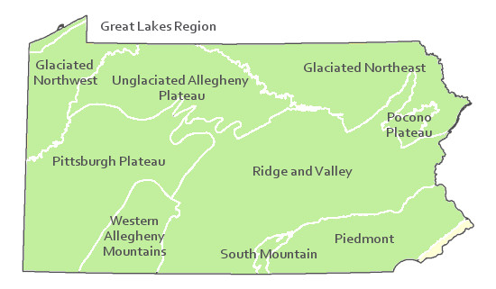
This community is found in the entire state except within the Coastal Plains.
Global Distribution
Pennsylvania, New York, New Hampshire, Vermont, Maine, and possibly Massachusetts and extends into eastern Canada.
Fike, J. 1999. Terrestrial and palustrine plant communities of Pennsylvania. Pennsylvania Natural Diversity Inventory. Harrisburg, PA 79 pp.
NatureServe 2010. NatureServe Explorer: An online encyclopedia of life Version 7.1. NatureServe, Arlington, VA. Available http://www.natureserv.org/explorer (accessed: 23 November 2011).
Pennsylvania Department of Conservation and Natural Resources (DCNR). 1999. Inventory Manual of Procedure. For the Fourth State Forest Management Plan. Pennsylvania Bureau of Forestry, Division of Forest Advisory Service.- Harrisburg, PA. 51 ppg.
Stone, B., D. Gustafson, and B. Jones. 2006 (revised). Manual of Procedure for State Game Land Cover Typing.- Commonwealth of Pennsylvania Game Commission, Bureau of Wildlife Habitat Management, Forest Inventory and Analysis Section, Forestry Division.- Harrisburg, PA. 79 ppg.
